


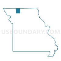
Ridgeway Voting District, Harrison County, Missouri
About
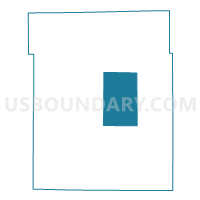
Outline

Summary
| Unique Area Identifier | 607998 |
| Name | Ridgeway Voting District |
| County | Harrison County |
| State | Missouri |
| Area (square miles) | 51.48 |
| Land Area (square miles) | 51.12 |
| Water Area (square miles) | 0.36 |
| % of Land Area | 99.30 |
| % of Water Area | 0.70 |
| Latitude of the Internal Point | 40.35379100 |
| Longtitude of the Internal Point | -93.92690830 |
Maps

Graphs
Select a template below for downloading or customizing gragh for Ridgeway Voting District, Harrison County, Missouri


Neighbors
Neighoring Voting District (by Name) Neighboring Voting District on the Map
- Bethany East Voting District, Harrison County, MO
- Bethany West Voting District, Harrison County, MO
- Cainsville Voting District, Harrison County, MO
- Eagleville Voting District, Harrison County, MO
- Mt. Moriah Voting District, Harrison County, MO
Top 10 Neighboring County Subdivision (by Population) Neighboring County Subdivision on the Map
- Bethany township, Harrison County, MO (3,674)
- Grant township, Harrison County, MO (459)
- Marion township, Harrison County, MO (445)
- Madison township, Harrison County, MO (437)
- Union township, Harrison County, MO (411)
- Jefferson township, Harrison County, MO (328)
- Trail Creek township, Harrison County, MO (216)
- Sherman township, Harrison County, MO (175)
- Fox Creek township, Harrison County, MO (105)
Top 10 Neighboring Place (by Population) Neighboring Place on the Map
Top 10 Neighboring Unified School District (by Population) Neighboring Unified School District on the Map
- South Harrison School District, MO (5,688)
- North Harrison R-III School District, MO (1,436)
- Ridgeway R-V School District, MO (735)
- Cainsville R-I School District, MO (508)